Mapping traffic signs just got a lot faster. The latest monthly update of the Talking Maps initiative has just been released and highlights all traffic signs detected during the entire month of December 2019. This Talking Maps collaboration project was initiated a year ago between AND Products BV and the Ministry of Infrastructure and Water Management from the province of North Brabant. And most recently the province of Overijssel joined forces.
The data, based on real time information is collected by smart vision sensors and is aimed at consolidating asset management through targeted and functional inspections, which ultimately will result in greater road safety. Indeed, the information collected is backed by confidence ratings and automatically validated by inspectors from both provinces driving their vehicles every day and updating the database.
Innovation was at the heart of this collaboration effort according to the province of North Brabant. Now that the Overijssel province has joined the emphasis is more towards research and compliance. One of the key benefits of this Talking Maps project is that that all members can use the data generated for testing purposes.
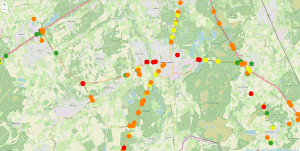
The traffic sign information such as longitude, latitude, confidence levels are highlighted on the image below:
This latest monthly update is the first one of many more to come. From now on, the information will be released on a monthly basis.
AND is extremely proud to be helping Dutch provinces to enrich their location-aware content database.
Stay tuned for future updates.