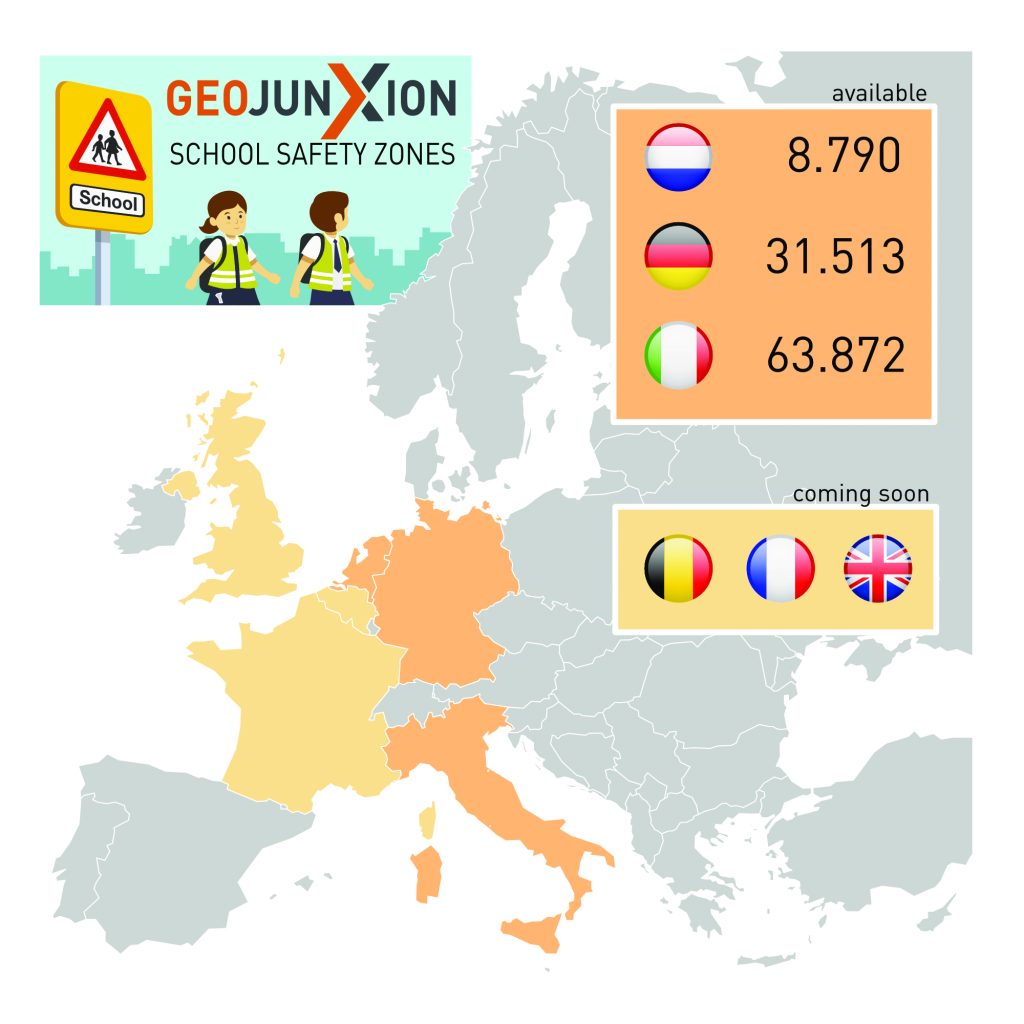
SCHOOL SAFETY ZONES
You are about to enter a School Zone!
Either you are a manufacturer of car navigation systems, a delivery company with logo on your vehicles, an organization developing transport and logistics planning and routing solutions, and insurance, insurtech, real-estate or geomarketing company, or even a municipality with the intent to analyze and build smart areas around schools, GeoJunxion School Safety Zones are made for you.
School Zones are put in place to ensure the safety of children around schools and kindergartens. Drivers are responsible for maintaining safety and awareness on the streets surrounding those areas. All children should be able to walk or bike to and from school without fear of being hit by passing vehicles. As drivers, we must keep the highest possible attention around school zones, recognize them, whether they are officially delimited or not, reduce the speed when approaching and crossing them, expecting increased traffic congestion at certain times of the day, paying particular attention to bus stops and crosswalks. While not all countries have defined a standardized approach to School Zones, drivers must be aware of such critical areas either enforced by law or not.
This dataset can be utilized in many market sectors, such as: Navigation, Fleet Management, Transports and Logistics, Real Estate, Insurtech, Geomarketing, Smart Cities, Municipalities and Governments.
Key Features
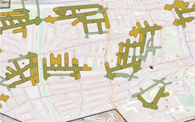
- Polygons/boundaries; streets around schools and kindergartens
- Address information of schools and kindergartens
- Zones based on information such as road network, road intersections, cross walks, public transport spots, parking areas
- Polygons/boundaries around schools and kindergartens taking into account increased traffic at certain time of the day
- Polygons/boundaries with information about opening and closing hours and public holidays for a more precise traffic/congestion prevention
- Schools and kindergartens types and address information
- Consistent and complete map agnostic content to be utilized in overlay or in background to any other mapping platform
- Simple access to RAW data or through API
- Coverage in continues expansion
- Yearly update
In addition to School Safety Zones, as subset of the Safety Alert Zones, the High Alert Zones expanding suite of map agnostic content designed to foster safety and sustainability currently offers: other Safety Alert Zones: bridges, tunnels, accident prone areas, Eco Alert Zones, Health Alert Zones and Hazard Roads US