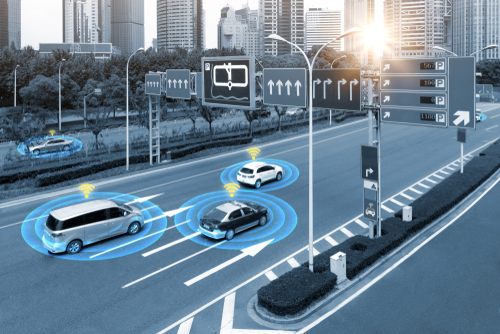
Geofences are a powerful tool for urban and community planning to manage mobility
With geofencing, cities can establish virtual boundaries that allow them to control and monitor the movement of people and vehicles within their city limits. Urban Mobility Geofences can be used to restrict access in certain areas or times of day, such as during rush hour or at night; School Zones help protect children by limiting vehicle speed near schools or even close streets during opening and closure times (School Streets); Parking Geofences enable parking enforcement in certain areas for example for shared mobility; remote speed control, also known as geo-fencing, allow operators to automatically slow vehicles down in specific areas; Low-emission zones geofences help reduce air pollution by restricting access from high-polluting vehicles or even activate temporary zones. All these examples demonstrate how geofencing technology helps Smart Cities to improve safety, sustainability and efficiency in urban environments.
Adding time applicability makes such georeferenced fences even more smart: they become dynamic tools which respond according to real-time conditions, allowing users better control over their environment while also making it easier for authorities to enforce regulations related with traffic flows or environmental protection policies. This way citizens feel more empowered about managing mobility on their own terms while still being compliant with local laws – an ideal win/win situation that benefits both sides.
Urban vehicle access regulations (UVARs) also help make cities more liveable, healthier and more attractive. Within the context of UVARs in urban areas, geofencing serves the two main purposes of speed reduction and emission reduction. Geofencing for speed reduction can give a driver a warning about excess speed and it may be used to prevent a vehicle from being able to exceed the posted speed limit.
Geofences around Schools
Geofences around Schools or other critical locations help protect vulnerable pedestrians, reduce air pollution and traffic congestion. When properly integrated and utilized in various GPS-based applications, geofences can help protect students, reduce air pollution, and ease traffic congestion around schools and other critical areas (like hospitals, playgrounds and more). Read more about Safe School Routes, for example School Streets, School Zones and other Zones.
Geofences are virtual boundaries built around real-world locations like schools. GeoJunxion B.V. develops geofences that, when properly integrated and utilized in various GPS-based applications, can help protect students, reduce air pollution, and ease traffic congestion around schools and other critical areas (like hospitals, playgrounds and more).
Examples of Smart & Dynamic Geofences for Urban and Community Planning
- Micromobility Geofences
- Last-mile Mobility Geofences
- Urban Mobility Geofences
- Mobility Hubs Geofences
- Parking Geofences
- Pedestrian Zones Geofences
- Smart Urban Traffic Zones
- Speed Control Geofences
- Low Speed Zones
- Geofencing for Safety Zones
- Geofencing for Low-emission Zones
- Geofencing for Limited Traffic Zones – ZTL Zones
Location Intelligence Data Services
Geofences are a powerful tool to manage Smart Cities. GeoJunxion can create any type of geofence for any use case. Interested to understand how GeoJunxion can help you? Contact us and send an email to sales@geojunxion.com!