GeoJunxion exhibits at polisMobility 2023 in Cologne
GeoJunxion exhibits at polisMobility 2023. polisMobility 2023 takes place in Cologne (Germany) from 24 to 26 May 2023. polisMOBILITY is with its innovative format of a 360-degree experience of the future of urban mobility, polisMOBILITY sets impulses and enables encounters between politics, administration, business, science and civil society.
You can find the Dutch company GeoJunxion on the the Dutch Lounge in Koelnmesse’s in Cologne in Hall 1.2. Most of Cologne’s metropolitan area is a low emission zone. However, the entrance to Koelnmesse can be reached without entering the Umweltzone. Read more about low-emission zones in Cologne/Koln.
GeoJunxion at Polis Mobility
Product Portfolio GeoJunxion
GeoJunxion will showcase its product portfolio centered around safety on the road and contributing to a more sustainable world and serve solutions for smart mobility cities, shared mobility, urban logistics, autonomous vehicles. For example:
Low Emission and Congestion Zones

Low Emission and Congestion Zones database
Low Emission and Congestion Zones are areas with driving restrictions to combat traffic congestion and improve air quality. GeoJunxion aggregated this environmental data aggregated in a geographical database. Examples of such driving restrictions to combat traffic congestion and improve air quality are: Low Emission Zones, Congestion Charging & Limited Access Areas. Such driving restrictions affects various types of transports with different engines, including light and heavy vehicles. Our database currently includes 2,800+ zones.
Most of Cologne’s metropolitan area is a low emission zone. Vehicles entering this zone must carry a green sticker. However, the entrance to Koelnmesse is also secured for vehicles without stickers. Read more about low-emission zones in Cologne/Koln.
Safety Geofences
Smart geofences database
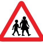
Smart and dynamic geofences are part of the Safety Alert Zones suite of products and are designed to help make roads and people safer. Typically, those areas have a higher probability of accidents in certain specific conditions. For example, at location such as schools, hospitals, playgrounds, tunnels, bridges, accident-prone areas and many more.
The smart and dynamic geofences are often time and weather dependent, around areas with higher probability of accidents in certain specific conditions.
Last Mile Maps for Events
Customized Maps for Events
Last Mile Map for Events provide both the visitor and the organization with a user-friendly, effective geo-awareness service, and planning and navigation system. The Maps can be tailored to any event, including temporary (pedestrian) roads used only for the event. With this tool both the visitor and the organization has access to a user-friendly, effective geo-awareness service, and planning and navigation system.
Users easily locate themselves on the map and plan their route from their position to any facility in the event area. On the other side, venue owners can make use of the same map as a tool to effectively plan the event and track/optimize the crowd within the location. The GeoJunxion Map Tile Server (Deutsch) will be used as a background Map. This TileServer works with any website, solution or application and can be adjusted to the customer look and feel.
Location Intelligence Data Services
Data Services
By leveraging our experience in Map Making, GeoJunxion helps others in custom data search, data collection, data aggregation, data harmonization and data normalization. Such data services could not only be used to enhance digital maps, but also to enrich smart city and urban logistic solutions. The service includes extensive quality and consistency checks. A typical assignment could, for example, involve normalising countless different sources of address data to create one homogenous database. An other example would be to source specific locations such as low traffic neighbourhoods on one continent to create dynamic geofences for urban mobility.
Meet GeoJunxion at polisMobility
Plan a meeting in advance to discuss how we can build mobility products together using smart data and geofences. You can either send an email to sales@geojunxion.com
GeoJunxion exhibits at various Events in 2023. Visit our Events Page for more information.
How to get there?
Most of Cologne’s metropolitan area is a low emission zone. Vehicles entering this zone must carry a green sticker. However, the entrance to Koelnmesse is also secured for vehicles without stickers. Read more about low-emission zones in Cologne/Koln.
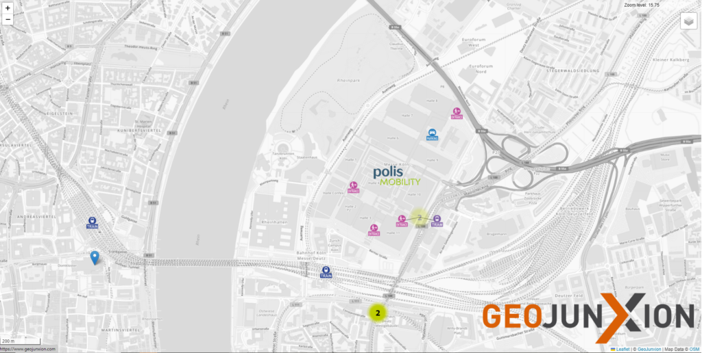
For visitors of the polisMOBILITY expo & conference the entrance West is open. Access is from Deutz-Mühlheimer-Strasse at the height of the East Entrance. There, simply follow the signs to the West Entrance. See the map below for more detail, this map was build with the GeoJunxion Map Tile Server (Deutsch).